Boots on the Ground and Surveying Innovation for Project Matador
Project Matador, located in Amarillo, Texas, is a groundbreaking artificial intelligence campus developed by Fermi America to supply large, reliable power volumes for hyperscale data centers and AI infrastructure. In partnership with the Texas Tech University System, the project is planned for approximately 15 million SF of data capacity, with a total power output of 11GW. This is equivalent to the power needed for 8.25 million to 11 million average U.S. homes.
Parkhill is providing civil engineering and architectural services for the project, focusing on the development of the overall campus infrastructure and site buildings. Surveying is a significant part of the project’s development and success. The team’s responsibilities include topographic design surveys, locating and establishing boundary lines, and construction layout staking.
“Surveying is a necessity for the development and construction of Project Matador,” said Camden Edwards, a member of Parkhill’s Survey Team. “It lays the groundwork for design teams, offering a clear understanding of the property’s characteristics and components. The survey team’s efforts also deliver the alignments, coordinates, and elevations that contractors rely on to move the project forward.”
Role in Campus Development
In the surveying profession, setting an alignment means establishing a precise horizontal or vertical route, path, or centerline for linear infrastructure projects such as roads, pipelines, or railways. This process defines the location and direction, combining lines and curves to guide construction and site design.
According to Jonathan Morris, Parkhill construction manager, the team established control points for the overall site and was instrumental in setting waterline alignments and locating groundwater storage tanks. They also set the alignment for the security boundary fence and coordinated with the gas pipeline contractor to establish the pipeline alignment. The 6.5-mile fence included multiple turns along the property boundary.
Innovation played a key role in surveying the vast site. While much of the work is completed on the ground, Parkhill incorporated a LiDAR aerial flight to collect data from above. This approach, which combines aerial and ground survey data, resulted in a timely and accurate site survey.
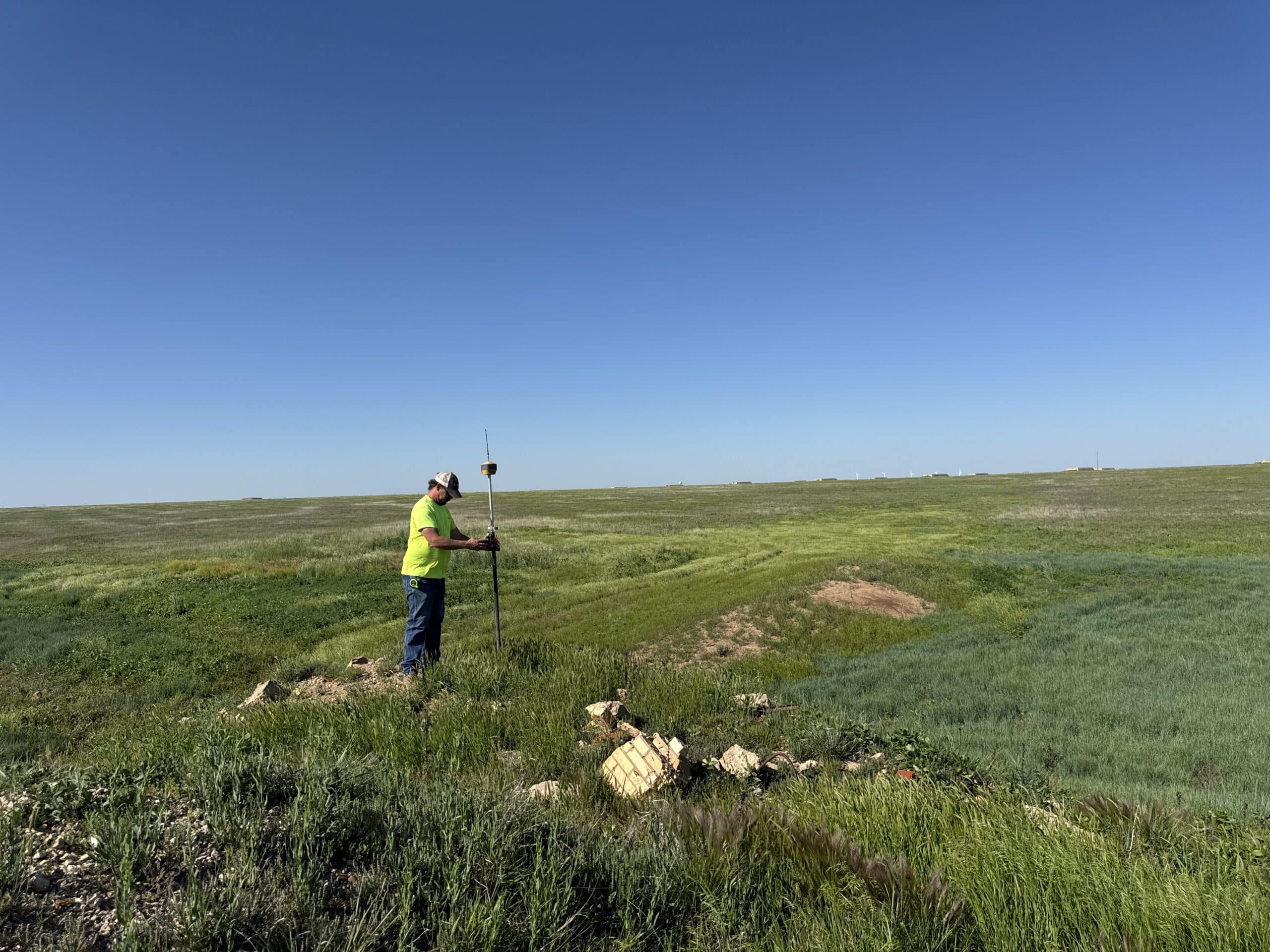
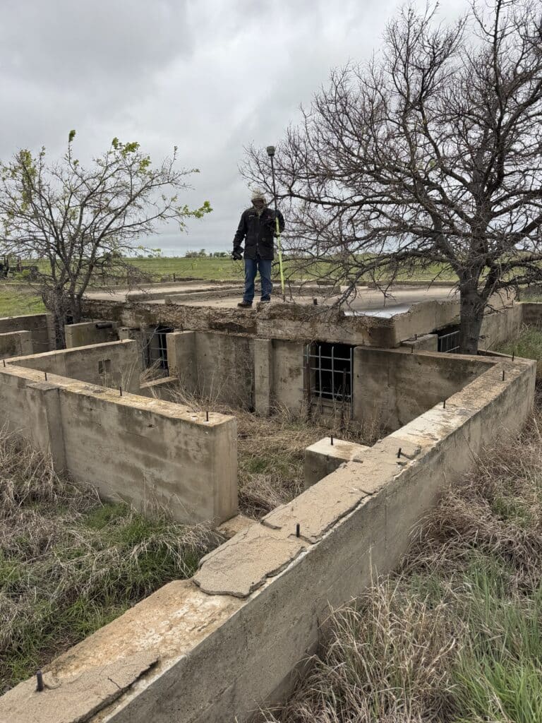 The responsibilities of the Survey Team include topographic design surveys, locating and establishing boundary lines, and construction layout staking. A survey crew (pictured here) member locates and outlines existing structures on site. A number of these concrete barriers were constructed in the WWII era.
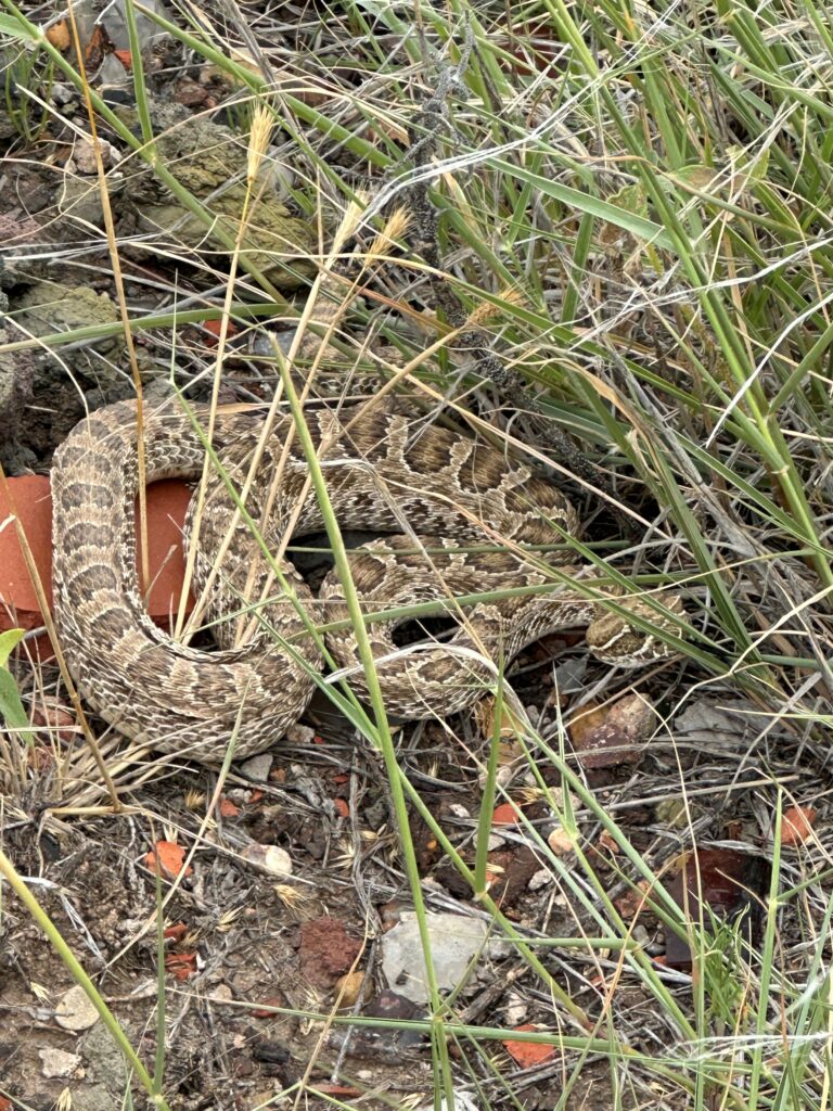 The natural environment adds another layer of complexity, including weather, vegetation, terrain, and wildlife.
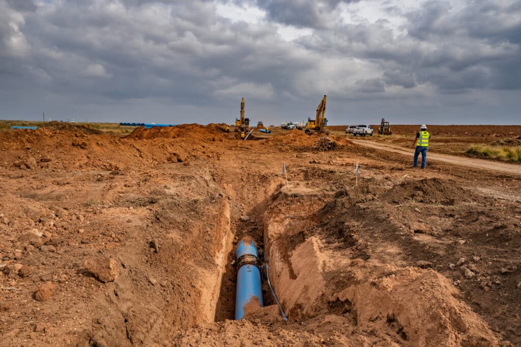 The team helps establish the control points for the overall site and utilizes them for water line alignments, such as this section of the on-site water line campus loop, and the location of groundwater storage tanks.
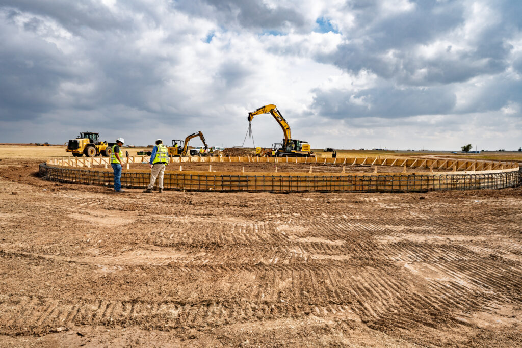 Parkhill team members examine form work bracing and rebar cages for a groundwater storage tank’s ring footing.
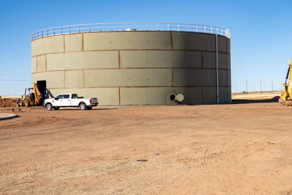 This groundwater storage tank will hold 2 million gallons of water.
Navigating Obstacles and Surveying Personal Growth
The project also presented unique challenges. Coordination with the neighboring Pantex nuclear weapons assembly and disassembly facilities is required daily, and sometimes hourly, with every movement on site monitored and communicated to the Pantex control tower.
The natural environment added another layer of complexity, including weather, vegetation, terrain, and native wildlife residents. Camden said that he encountered snakes daily. These obstacles, unique to Project Matador, required safety measures and coordination to protect the well-being of survey crews on site.
“I have grown tremendously as a surveyor from the survey efforts on Project Matador,” Camden said. “A personal highlight would be the relationships I have established with colleagues within Parkhill, as well as relationships created with other workers on the site.”