Surveying Using Google Earth and KMZ/KML Files
Category: University Of Parkhill
Written By: Kenny York
Date: June 2, 2021
How Parkhill uses KMZ/KML files for everyday life as a surveyor on Google Earth.
Google Earth is for fun and profit. It is also a vital asset to Parkhill and Lemke Land Surveying, and the survey team uses it daily, as discussed by Clay Kilmer at the University of Parkhill virtual course in April 2021. Kilmer is a geologist and former member of the Parkhill Environmental Group who currently consults with Parkhill on waste management, water resources, and environmental compliance and restoration projects.
“The primary goals of the class were to introduce Parkhill folks to Google Earth, to demonstrate its wide functionality and ease of use, and to show those who already use Google Earth a few tools, capabilities, and related resources they may not be aware of,” Kilmer said. “The class presentation was formatted as a teaching resource for Google Earth functions.”
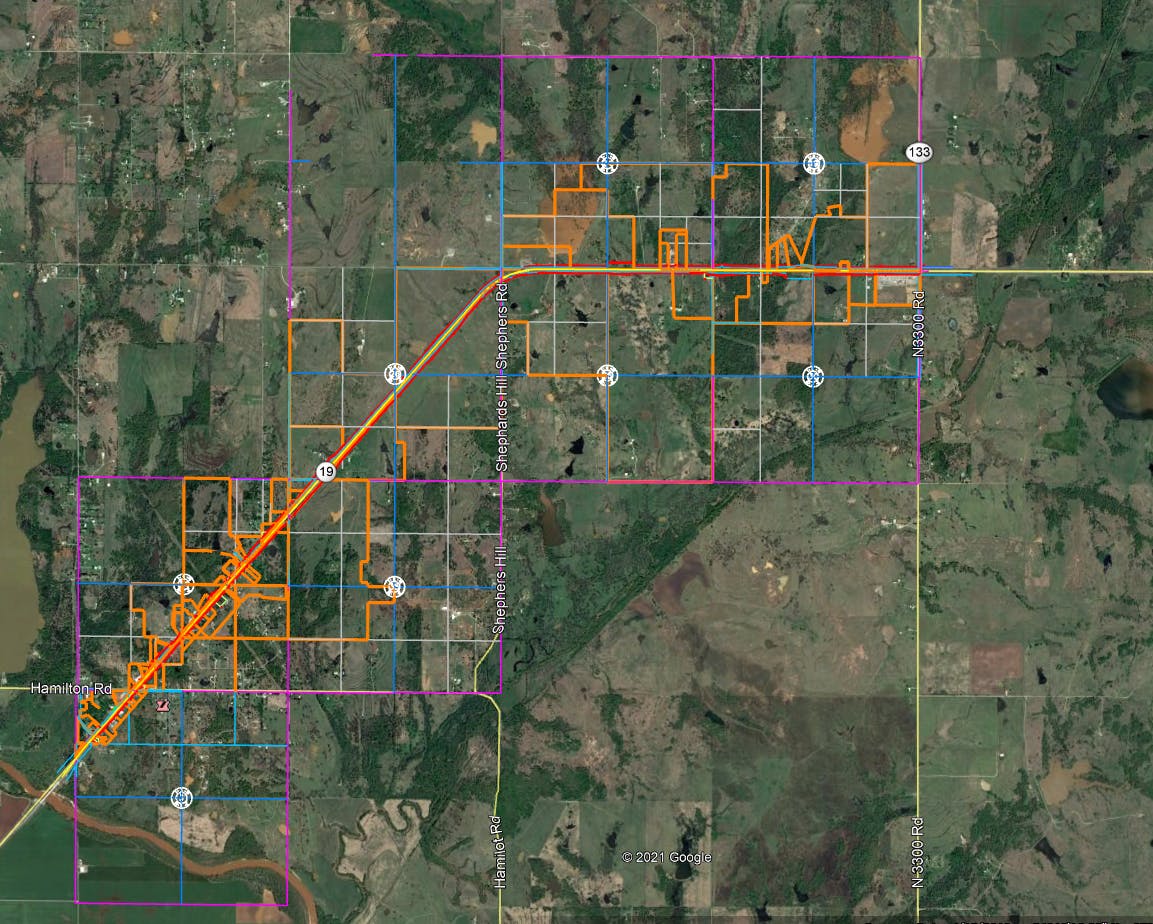
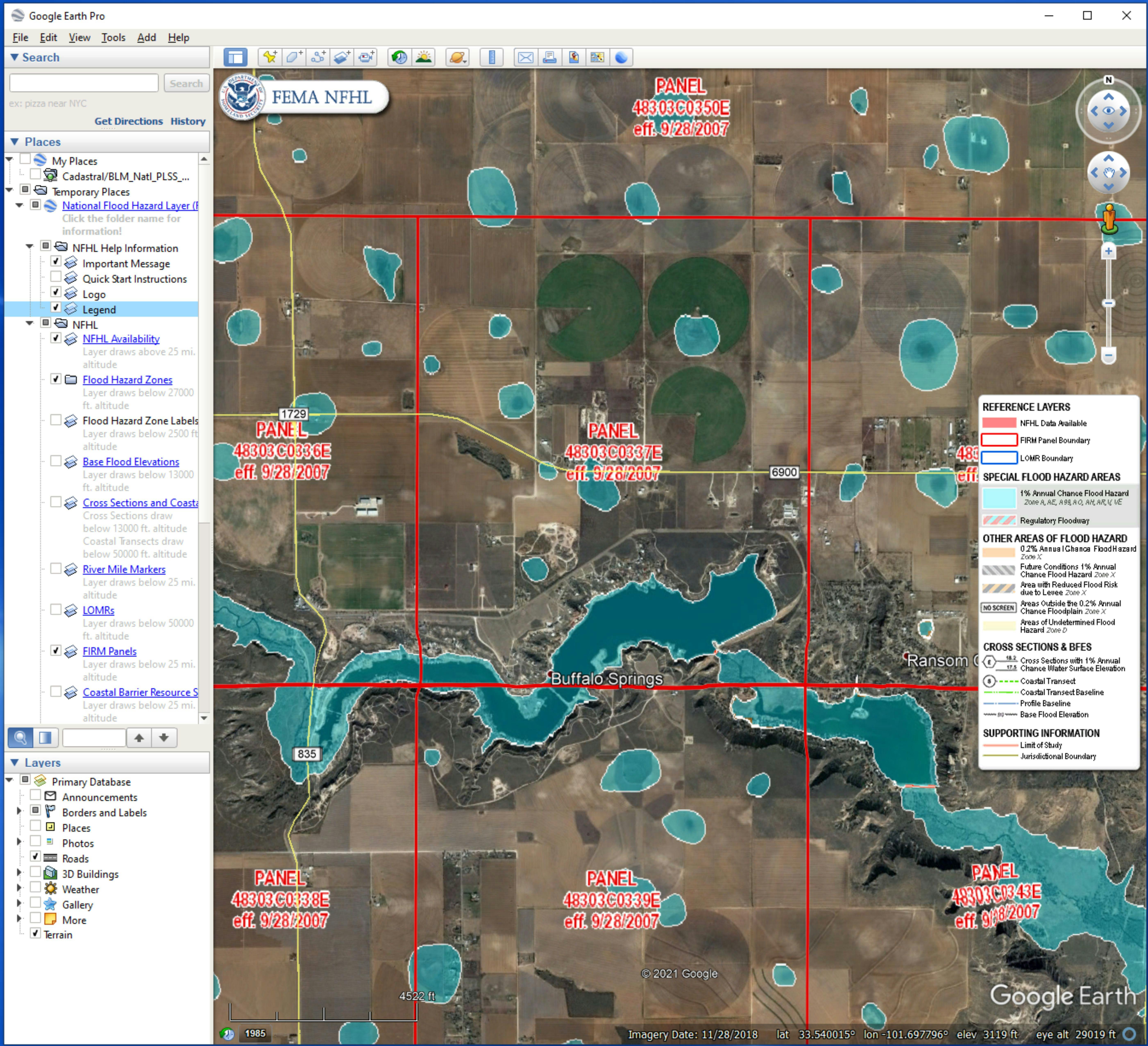
The Survey Team can store projects that contain vital information to quickly access details needed for Parkhill | Lemke projects and define the limits of a survey for proposals. By keeping the project in a Keyhole Markup Language or KML/KMZ file, the Survey Team swiftly locate the project area, boundaries, client name, control points, and monuments with images. The downloadable KMZ file allows the crew to share the file with their data collectors while on the survey site.
This will enable them to accurately pinpoint the control areas and boundary lines efficiently. By doing this, the crew does not take on more information than they need which also saves time and money. The firm’s UAV pilots also use the KMZ files and Google Earth to overlap and set the flight paths within the boundary lines/control points for an accurate topographic, aerial image of the project. By having these control points, project employees then have a known geographic location of the photos taken from the drone within the survey area.
“Since Google Earth software is free and its basic functions are widely applicable and easy to learn, it can make a useful addition to any Parkhill employee's desktop,” Kilmer said. “Possibly the greatest value of Google Earth is as a communications tool. Files may be shared with Parkhill Team members and our sub-consultants to provide critical project information in real-time.
Google Earth files may also be shared with clients to boost their understanding of projects and increase their perception of the value of Parkhill's services.”
This is just a quick overview of how the files are used at Parkhill and Lemke Land Surveying. The list below shows the information the KMZ files can contain for a survey team.
Project Info
· Project Areas/Boundaries
· Client Name
· Project Number
· Coordinate System
· Control
· Monuments with pictures
· Virtual Site Visit
· View improvements (aerial and street view)
· Check the vegetation and canopy
· Visualize boundary
· View section lines
· View Control